
This lesson will discuss erosion control practices in the agricultural and construction environments. The impact of erosion management practices will be demonstrated with exercises using a USLE calculator.
|
|
| Lesson Navigation Tips: |
|
Abstract:
Erosion control measures are intended to prevent and/or reduce movement of eroded soil sediments off-site/land. Selection of the proper erosion control measure must take into consideration the magnitude and type of erosion, as well as the resources available for implementation. This lesson will consider various control measures used to prevent erosion, and minimize its effects on soil resources, water and air quality, and human health. It will discuss erosion control practices for both cropland and urban environments. The impact of various control measures on erosion factors will be demonstrated with exercises using an interactive Universal Soil Loss Equation (USLE) calculator. The lesson is written to target educational needs of lower level undergraduate students and is open for the use by the public and educational institutions. Depending on the goals/objectives of a course, training, workshop, part or all sections of the lesson can be used.
Upon completing this lesson, a student should be able to:
Assessment:
Development of this lesson was supported in by USDA Cooperative State Research, Education, & Extension Service (USDA-CSREES), under Contract Number 2003-51130-02072.
Any opinions, findings, conclusions or recommendations expressed in this publication are those of the author(s) and do not necessarily reflect the view of the USDA-CSREES. Journal Series No. 05-01 of the University of Nebraska College of Agricultural Sciences and Natural Resources, Linocln, NE.
ObjectiveBy the end of this section the student/user will be able to:Describe erosion control measures of urban land.Accompanying Exercise: (For students to print off, complete, and turn in for a grade) Erosion Control Measures of Urban Land- Exercise (pdf) |
Construction Erosion Control:
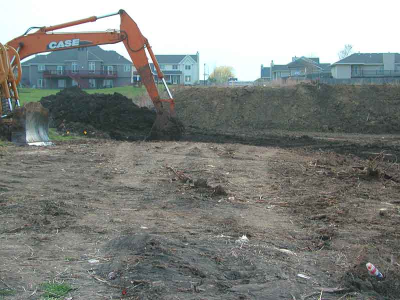
A major component of construction is the clearing and grading of land, which exposes, disturbs, and moves the soil. This inevitably increases an area’s susceptibility to erosion. Since in these situations it is not feasible to eliminate all erosion risk factors and, thus, all erosion, the goal of implementing erosion control measures is primarily to minimize erosion.
The benefits of implementing effective erosion control measures include the reduction of soil washed off-site and reduced clogging of streets and drainage systems, as well as reduced damage to adjacent properties. There are several best management practices that can be implemented to reduce erosion in construction sites and minimize movement of sediment into drainage systems.
When soils have been disturbed, erosion can be minimized with one or more of the following treatments.
Vegetative Cover:
Vegetative cover is efficient in reducing erosion and is a relatively inexpensive erosion control measure. Vegetative cover provides a canopy that covers the soil from the impacts of wind and water energy and a rooting system that holds soil particles together. Dense and short vegetative covers like grass are often more effective than tall and sparse vegetation for control of water erosion. Dense vegetation covers the soil surface and reduces the impact of energy of falling rain. On the other hand, dense and tall vegetative covers are more effective than short vegetation for control of wind erosion. This is because tall vegetation, depending on the wind speed, reduces the wind velocity, therefore, reducing its erosive energy.
Maintaining or Preserving Vegetation:
Existing vegetation is the best antidote for erosion. Trees, shrubs, and grasses that do not interfere with the construction process should be left undisturbed or maintained to minimize damage. The more vegetation area that is preserved the less area exposed to erosion.
Planting New Vegetation:
In areas of housing development, it is important to establish permanent vegetation to minimize soil exposure to water and wind erosion. Vegetation/plants that have fibrous root system with fast establishment of roots and ground cover are good options (see suggested list of shrubs). Temporary Seeding is the planting of grasses or plant materials that will quickly germinate and grow into protective cover for the soil until a permanent planting is established. Temporary seeding is recommended during the land grading and construction processes. Rapidly growing plants such as annual grasses, small grains, or legumes are appropriate temporary seeding options. Temporary seeding protects the soil and reduces mud and dust produced during construction. Thus, it is a short-term erosion control measure (Less than 1 year).
Permanent Seeding is the establishment of the appropriate grasses or plants in the construction sites. Unlike temporary seeding, permanent seeding requires that the construction phase be complete. Only then more appropriate and/or desired plants are established. Thus, permanent seeding is for long-term control of soil erosion. If the season is not appropriate for permanent seeding, temporary seeding options are often considered to minimize bare soil exposure until permanent seeding can be done. Either temporary or permanent seeding can be done through hand seeding and/or hydroseeding. Hydroseeding is done if the land is especially steep and irregular for hand seeding.
An area of bare soil highly susceptible to erosion. Hydroseeding is done by spraying on a wet mixture of mulch and seed. The same area after hydroseeding has been done. Images by www.trahonhydroseeding.com/pics.htm
The technique of Hydroseeding
Image by USDA
Hydroseeding Fact Sheet
http://www.nrcs.usda.gov/wps/portal/nrcs/detail/wy/technical/?cid=nrcs142p2_027264
Mulching:
Similar to seeding, mulching is a method of applying plant or non-plant materials to cover bare soil surface. The main goal of mulching is to protect the surface of the soil from the impact of erosive forces. In construction sites, mulch can be placed to minimize wind and water erosion. However, the type of mulching selection depends on the land (i.e., slope). Heavy and large sized mulch would be more appropriate for a steep slope. In steep or gentle slopes, matting can be done to hold the mulch in place and reduce its movement by wind or water.
Aside from protecting the soil from erosion, mulching conserves water and reduces soil temperature fluctuations. If the mulch is plant-based or organic, it also increases the soil tilth. For a table of the advantages and disadvantages of various mulch types, click the button below.
|
http://www.nrcs.usda.gov/Internet/FSE_DOCUMENTS/nrcs143_023231.pdf |
|
Thinking Question: Compare plant-based mulch and the synthetic mulch. Discuss the advantages and limitations of both. Why might a contractor choose one over the other? |
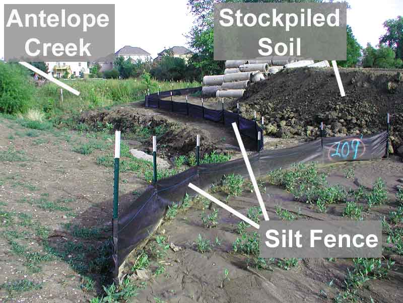 |
| A silt fence collects soil (or sediment) that would otherwise wash away with flowing water. Image by M. Mamo |
Silt Fencing:
Silt fencing is a temporary barrier placed along the perimeter of a construction site. Silt fence does not serve to prevent erosion; rather, it traps soil or sediment from leaving the perimeter of the construction site. To be effective, silt fence must be constructed carefully and be in place before construction begins. Silt fences are primarily intended for trapping sediment from water erosion. They are less effective for wind erosion because they are not tall enough barriers.
Gravel Access Path:
Gravel or rock driveways in construction sites can minimize tracking of soil or sediment into the streets by vehicles and equipment. In addition, compaction of soil on the rest of the construction areas is reduced by limiting vehicle movement to the gravel or rock driveway. Temporary rock areas should be underlayed with appropriate geotextiles. This limits the incorporation of rock into existing soil, which will support future plantings.
|
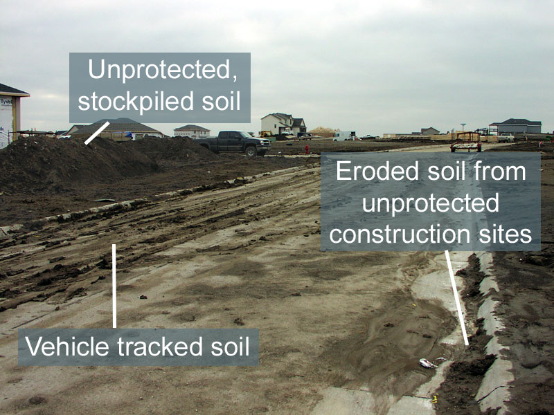
|
Unless gravel roads are in place and vehicle traffic is minimized, it is highly probable that vehicles will track soil into streets. The impact of soil tracked into paved roads can be significant since any rainfall runoff will carry this soil or sediment directly into the storm drainage system. If the soil has been tracked onto the pavement, the goal should be to minimize its movement into drainage ways. A practical and cost effective way to do this is to sweep or scrape soil on the paved road daily before it is moved by rainfall runoff.
|
Thinking Question: Vehicle traffic not only tracks soil onto paved roads but can cause soil compaction. How does this compaction influence soil erosion? |
|
Thinking Question: Soil is left stockpiled on the construction lot, which is typical in construction sites. What management practice would be useful in this case to minimize soil erosion from the pile to the paved road? |
Impoundments:
Impoundments are man-made ponds or lakes constructed to control storm run-off and/or trap sediments. Before soil or sediment reach the drainage system, detention ponds can be placed to trap and settle sediments. This in effect is NOT an erosion preventive measure but a measure to minimize the already detached or eroded soil from entering waterways. It is a sediment control measure.
There are two kinds of impoundments: permanent ones called retention ponds and temporary ones called detention ponds.
Wetlands:
Wetlands are areas that are frequently saturated by surface water or groundwater, staying wet at least part of the year (i.e., swamps, bogs, fens, marshes, and estuaries). Wetlands are often natural but can also be constructed. Wetlands are effective at controlling sediment and filtering nutrients and other chemical pollutants because they are a biologically active system.
Accompanying Exercise: (For students to print off, complete, and turn in for a grade)
Case Study: Managing Urban Construction Erosion- Exercise (pdf) |
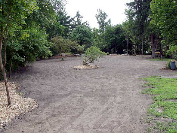
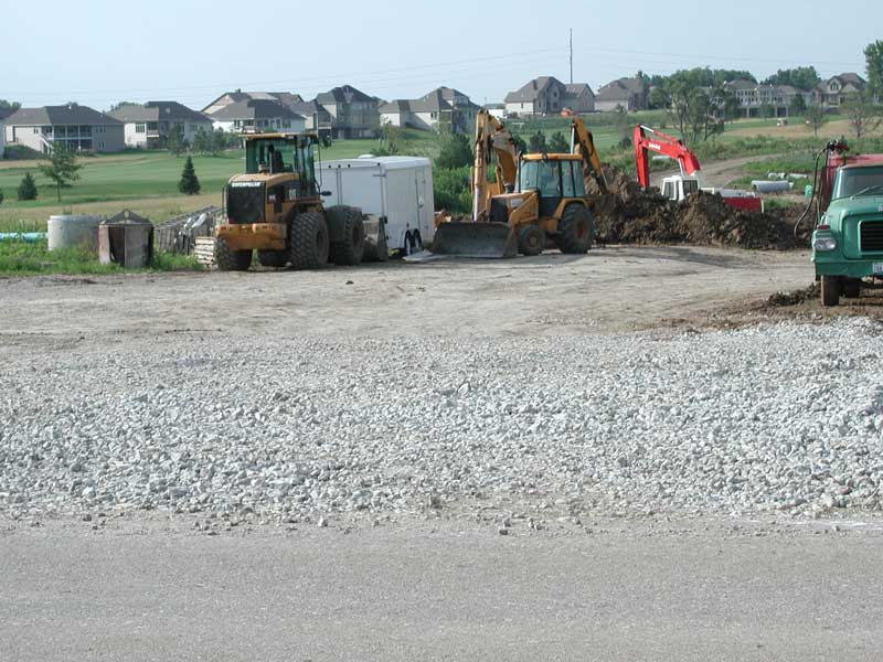
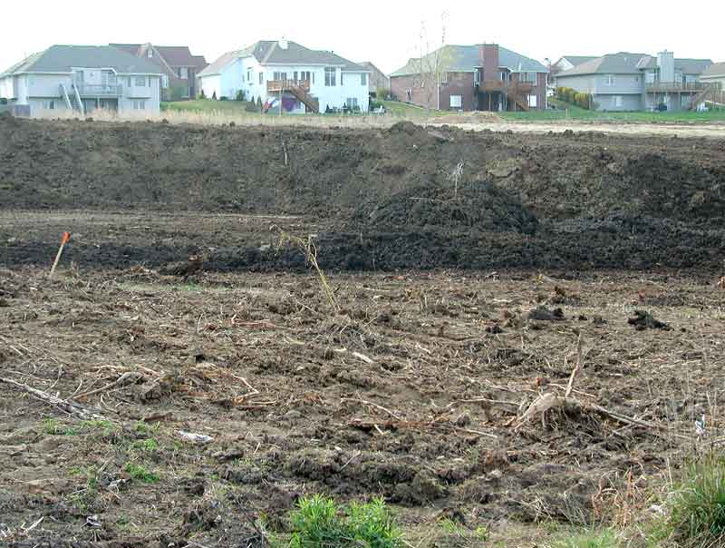
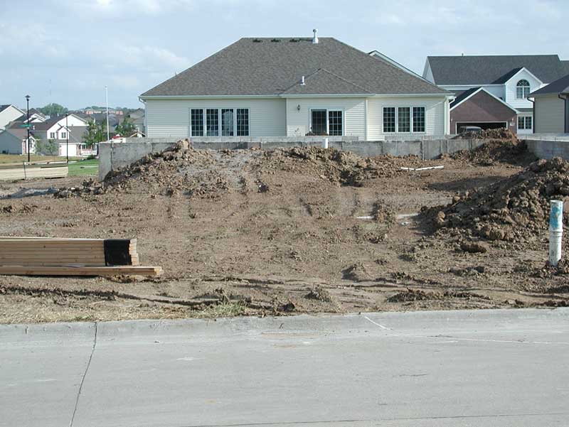
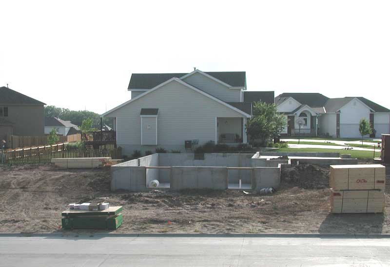
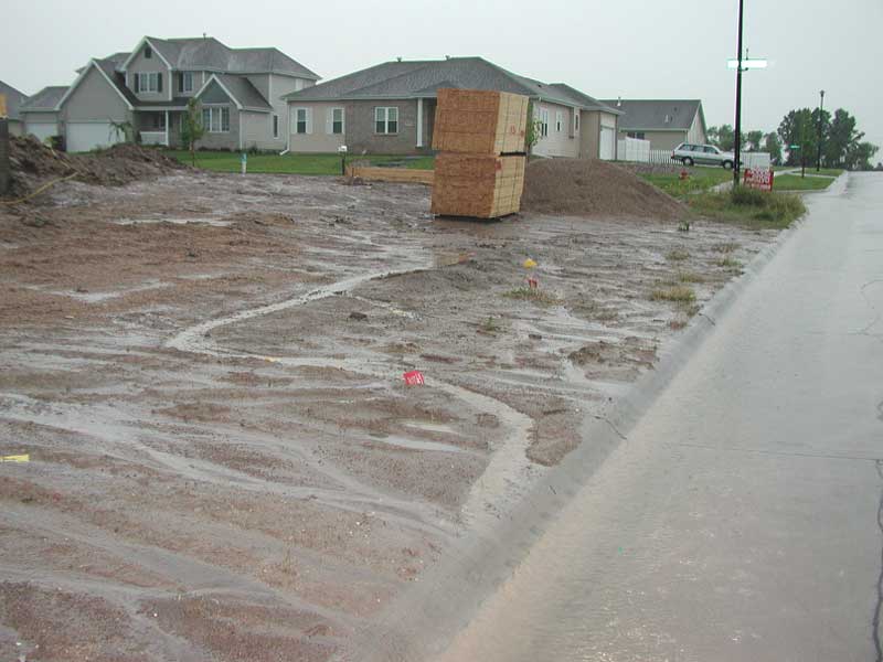
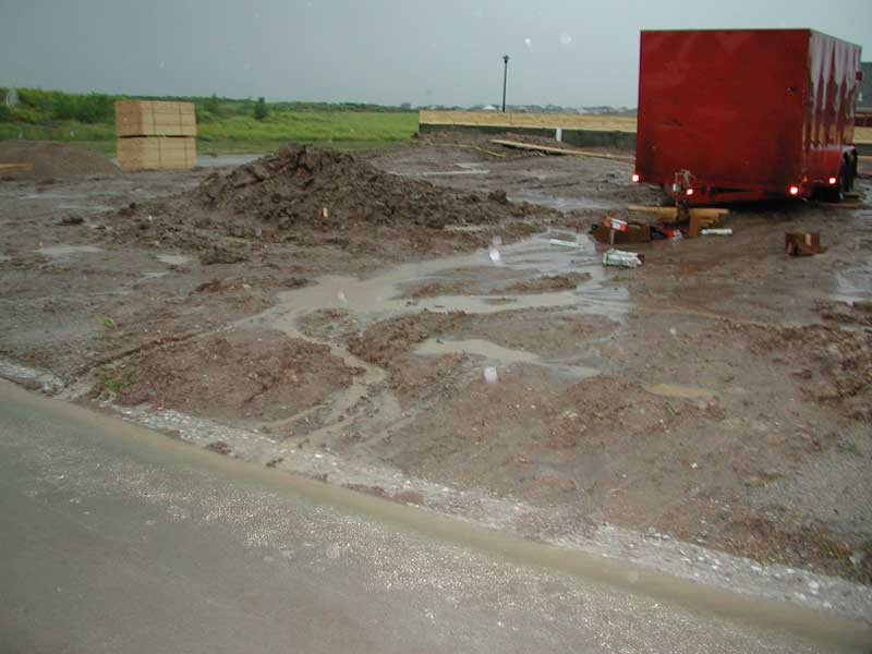
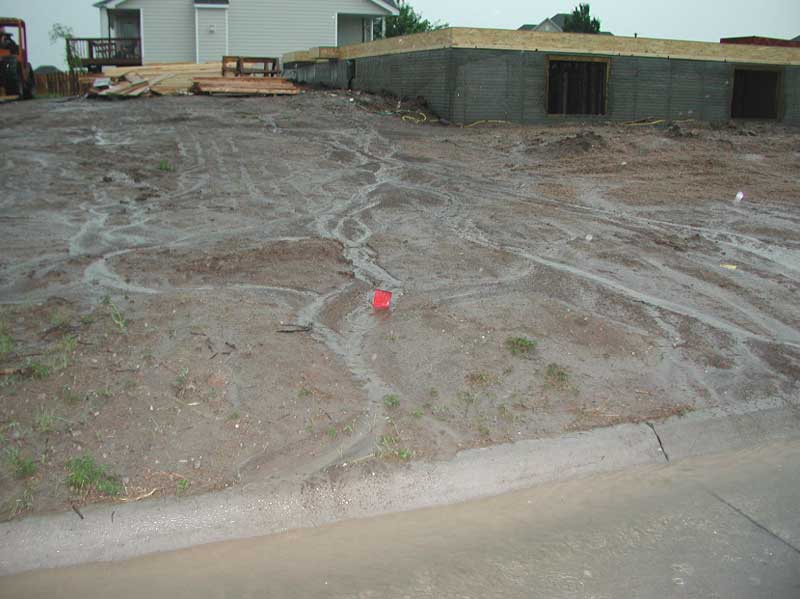
CASE STUDY
|
||||||||||||||||||
| Step 1) Describe the causes of erosion for this lot. | ||||||||||||||||||
| Step 2) Evaluate the type of erosion occurring on this lot. | ||||||||||||||||||
| Step 3) How does the presence of the housing structure affect the type and amount of erosion? | ||||||||||||||||||
| Step 4) Recommend management practices that could be implemented during the grading and construction phases to minimize erosion. | ||||||||||||||||||
ObjectiveBy the end of this section the student/user will be able to:Describe erosion control measures for cropped environments.Accompanying - Exercise: (For students to print off, complete, and turn in for a grade) Erosion Control Measures of Cropped Environments- Exercise (pdf) |
Earlier in this lesson, some erosion control measures for construction lands were described. This section of the lesson will focus on erosion control measures of cropped environments.
Vegetation:
Vegetative cover is the single most effective and economical measure to protect agricultural soil. The degree of soil protection depends on the cropping system and the vegetation type. The table below shows the erosion hazard of different cropping system compared to a control example of continuous clover. For example, the relative erosion hazard of leaving the soil fallow (land area left uncropped or unplanted) is 244 times that of continuous clover.
|
||||||||||||||||
|
Thinking Question: From the above table, why is the erosion hazard rated higher in the corn-soybean rotation compared to that of continuous corn? Continuous soybean cropping is not listed in the table. How might the erosion hazard of a continuous soybean system compare to those listed in the table above? Justify your speculation. Hint: See residue distribution difference in the erosion lesson at: Residue Cover Percentage Corn Residue Cover and Soybean Residue Cover |
||||||||||||||||
 This video explains the beneficial effects of vegetative cover in reducing wind erosive energy and trapping moving particles. Video Clip by Dr. John Tatarko, USDA |
This video clip explains how barriers alter the effect of the wind force on the soil surface. The video discusses the different types of barriers and their advantages and disadvantages. Video Clip by Dr. John Tatarko, USDA |
Residue Management:
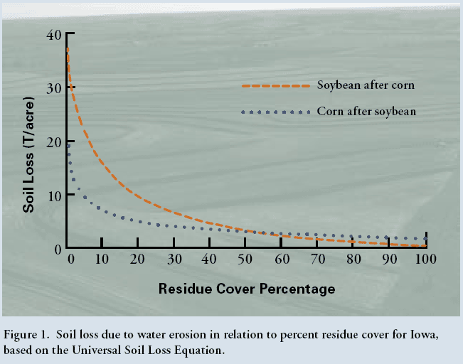
Residue is plant material, such as stems, leaves, and roots, left in the field after harvest. Leaving plant residue on the soil surface can protect the soil from both water and wind erosion. Residue covers soil particles so that they are less susceptible to being dislodged by the energy of water and wind. The degree of erosion control by residue cover depends on the residue type and amount. Residue percentage is a measure of the percent soil ground per unit area covered with residue. For example, in the chart below, a 50% residue soybean residue cover is as effective as a 50% corn residue cover. However, with less than 50% residue coverage, the corn residue is better at reducing erosion than soybean residue. This is because the size of leaves and stems of soybeans are smaller than corn, and therefore, offer less protection from wind and water.
 |
|
Soil loss due to water erosion in relation to percent residue cover for Iowa, based on the Universal Soil Loss Equation. Image by Iowa State University. |
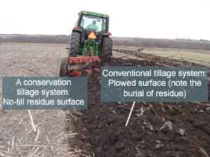
Tillage Management:
A tillage system that buries residue and pulverizes soil leads to high erosion risk. A tillage system that preserves surface residue and minimizes soil disturbance is desirable to reduce soil erosion. Tillage practices can be divided into 'conventional' and 'conservation' tillage. Conventional tillage creates more soil disturbance and mixing, while conservation tillage reduces soil disturbance to a minimum and keeps more residue from the previous crop at the soil surface.
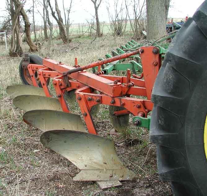
Conventional tillage operations use implements to mix or disturb the soil extensively, burying plant residue in the process. This leaves a rough surface that is then disked smooth to allow for better planting. Conservation tillage leaves 30% or more of the soil surface covered with plant residue, thus the degree of soil mixing is less than the conventional tillage system. In the photos below, discing and chisel plows bury some of the residue compared to no-till surface. Removing some of the residue by discing or chisel plowing increases the area of soil exposed to erosion (see photographs below).
|
||
|
Thinking Question: In the above picture, the conventional tillage system not only buries residue but also creates large rough surfaces. How does this affect soil erosion from wind and water? |
||
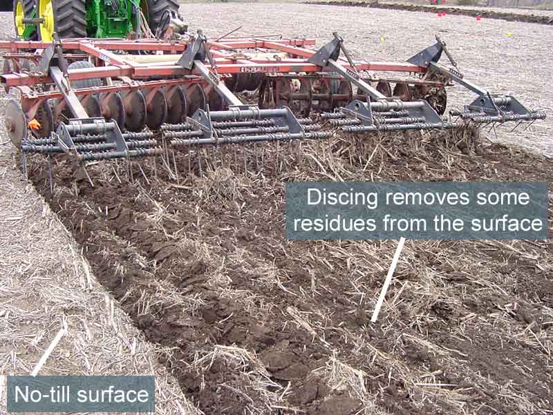 Discing Image by M. Mamo |
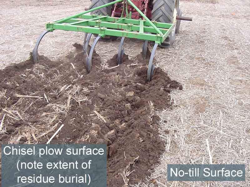 Chisel plow Image by M. Mamo |
|
This video clip explains how wind erosion can be reduced by roughening the soil surface and forming soil aggregates. This method of erosion control can be used when vegetation is sparse and/or the cropping system does not allow for vegetative cover. Video Clip by Dr. John Tatarko, USDA |
This video explains the beneficial effects of soil surface cover to control and reduce wind erosion. Video Clip by Dr. John Tatarko, USDA |
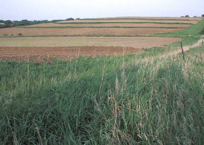
Contour cropping:
This management practice reduces risk of erosion by tilling and planting across (i.e., following the curvature of the land), rather than up and down, the hill as shown in the diagram below of strawberries planted on contour in California. Planting done along the contour reduces water erosion by enhancing water infiltration. Water infiltration is enhanced because the contour planting is perpendicular to the slope, slowing water velocity, and allowing more of the water to soak into the ground. If the contour is perpendicular to the prevailing wind, wind erosion is also reduced.
 |
|
Hillside contour strawberry farming in Monterey County, CA. Photo by USDA-NRCS |
Strip Contour Cropping:
Strip contour cropping is the management practice of growing two or more crops in alternating strips along the contour of the land. In this system, a row crop more susceptible to erosion ,like corn or soybeans, is planted alternating with a cover crop less susceptible to erosion, like grass meadow, clover, or oats. Similar to contour cropping, crops are planted perpendicular to the wind or water flow. Soil detached from the row crops by the forces of wind or water will get trapped by the cover crop.
 Strips of oats and hay are interspersed with strips of corn to save soil and improve water quality and wildlife habitat on this field in northeast Iowa. Photo by USDA-NRCS |
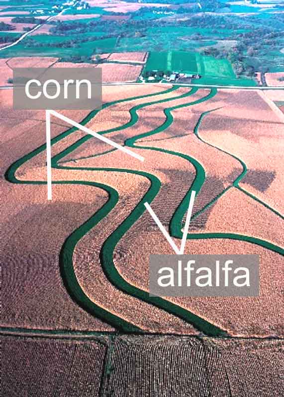 Aerial view of contour buffer strips on highly erodible cropland in Winneshiek County in northeast Iowa. Strips of green alfalfa help curb erosion by providing breaks from the more erodible corn fields. Photo by USDA-NRCS |
|
|
|
This video explains how strip cropping can reduce wind erosive energy and traps moving particles Video Clip by Dr. John Tatarko, USDA |
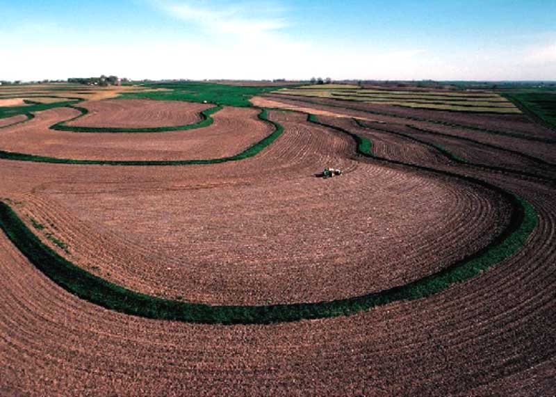
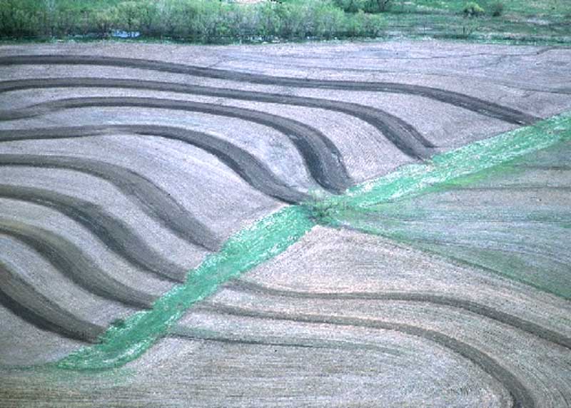
Terracing:
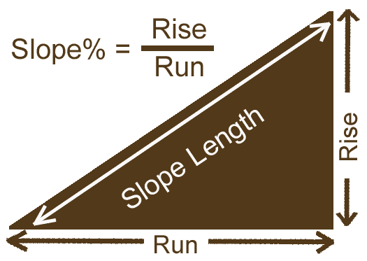
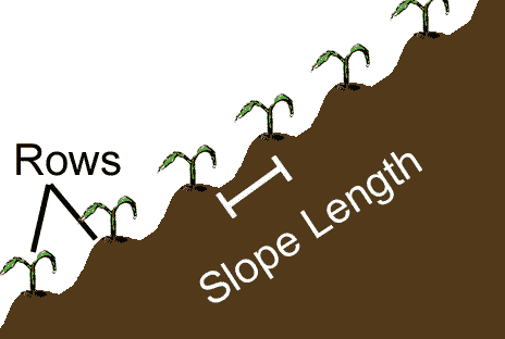
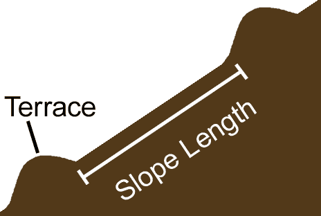
A terrace is an embankment constructed perpendicular to a slope to provide a barrier for water flowing down the slope as shown in the diagram. Terraces are often built following the curvature of the land. The presence of terraces reduces erosion by reducing the slope length and thereby reducing water runoff velocity as shown in the diagram below. The presence of terraces increases water infiltration and reduces runoff that can potentially erode soil. Excess water collected on the terraces drains either through a buried underground pipe system such as tile or through grassed waterways. Terrace building can be quite costly because it involves moving large quantities of soil and land grading to change the slope length.
 |
 |
 |
|
The velocity of water increases as slope length increases. Decreasing slope length by planting rows perpendicular to the slope or by adding terraces can decrease the velocity of water and, as a result, decrease its erosive potential. Images by UNL |
||
 A terrace in Sarpy County, NE. Image by USDA-NRCS |
 Terraces and no-till farming work to control erosion on a farm in Montgomery County, Iowa. Image by USDA-NRCS |
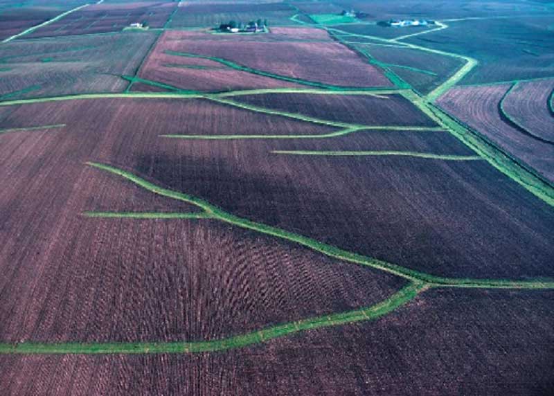
Grassed Waterways:
A grassed waterway is a natural or constructed ditch, usually broad and more shallow than the rest of the field, used to conduct surface water from or through cropland. Grassed waterways enhance water infiltration and trap eroded sediment. They are less costly to implement but require periodic maintenance to work efficiently. Grassed waterways also help in preventing the development of gullies in the fields because the grasses are purposely established in the lowest part of the landscape, where concentrated water flow will likely occur.
 |
 |
| A network of grassed waterways. | Contour terraces draining into a grassed waterway. |
|
http://extension.missouri.edu/publications/DisplayPub.aspx?P=G1504 |
|
Thinking Question: Discuss the advantages and limitations of grassed waterways in controlling erosion. |
ObjectiveBy the end of this section the student/user will be able to:Demonstrate effects of erosion management practices on annual soil loss using the USLE erosion calculator.Accompanying Exercise: (For students to print off, complete, and turn in for a grade) USLE Calculator- Exercise (pdf) |
The Universal Soil Loss Equation calculator is a tool used to estimate average annual soil loss caused by sheet and rill erosion. The equation is limited to making predictions for long-term annual soil loss only compared to making predictions on single rainfall event. In this lesson, you will use the model to evaluate the effects of various management practices on long-term annual soil loss.
The USLE Equation is: A = R * K * LS * C * P
Where,
A = predicted soil loss (tons per acre per year)
R = rainfall and runoff factor
K = soil erodibility factor
LS = slope factor (length and steepness)
C = crop and cover management factor
P = conservation practice factor
A - the tons of soil lost per acre each year. The value 'A' is usually compared to a value 'T'. T is the amount of soil loss that is considered 'tolerable'. Each soil series has a value T listed in the soil survey. Common values range from 1 to 5 tons/acre/year. When A is less than T, soil erosion losses from that land are not considered significant.
R - Rainfall and runoff factor. R is based on the total erosive power of storms during an average year and depends on local weather conditions.
K - Soil erodibility factor. Depends on texture, structure, and organic matter.
LS – L factor and S factor are combined into one factor.L - Length is the distance between the beginning of water runoff on the land and location of sediment deposition on the land or runoff enters a well-defined channel. The slope length factor computes the effect of slope length on erosion. Slope length longer than 1000 ft are not used in this interactive calculator because the calculation may not be reliable.C - Management factor. Compares cropping practices, residue management, and soil cover to the standard clean fallow plot. C-factors for different management practices are developed based on their observed deviation from the standard, which is clean-till with continuous-fallow conditions.
S - Slope steepness. The slope steepness factor S computes the effect of slope steepness on erosion.
P - Conservation practices implemented into the management system. It is the soil loss with contouring and/or strip cropping, or terracing to that with straight row cropping/planting up-and-down slope (i.e., parallel to the slope).
|
Thinking Questions: Explain how each of the six factors in the Universal Soil Loss Equation (USLE) influence the amount of soil lost by water erosion. Which of the factors of the USLE can be controlled by the land manager? |
|
Summary of Erosion Lesson:


